Kyle Kingsberry
@kkingsbesaas
Project
Carto Artcartoart.net
Turn Any Place on Earth into Wall Art
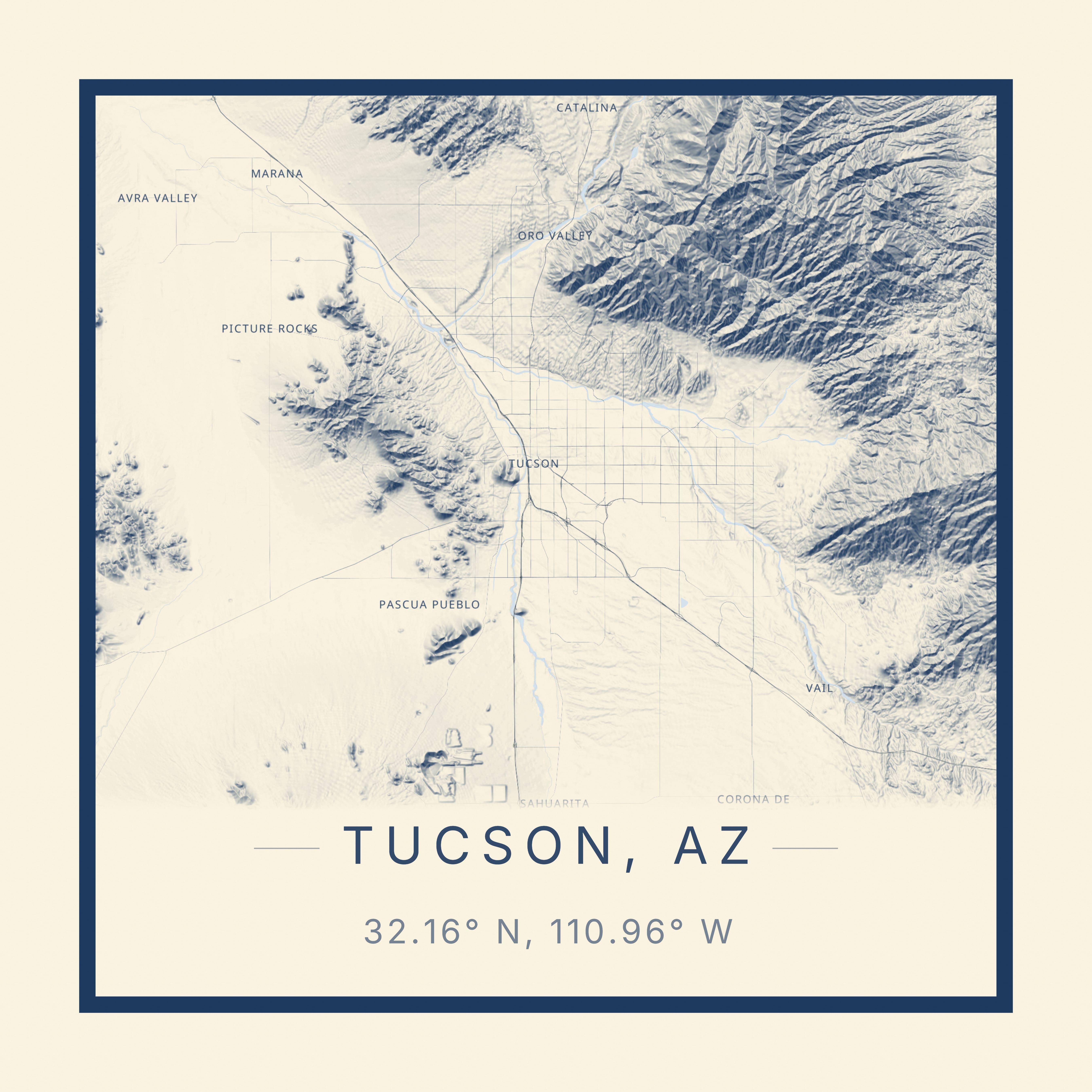
Today, the focus for Carto Art was with cleaning up the WIP colored hillshading layer. This works by taking the elevation data per tile as input, and then normalizes the elevation values and maps onto a color ramp gradient. Then, this layer gets draped over the map/terrain layer as a custom source, allowing for not only this beautiful view from top-down, but also while viewing in 3D mode with volumetric terrain.
Very happy with how this turned out from an artistic perspective!
Try out Carto Art yourself at cartoart.net
Thanks for the heads up!
Hey guys!
I am the developer behind Carto Art, and have been working on it for around a year at this point. This began as a frontend-only prototype inspired by a street vendor selling simple map prints. The realization that a more powerful, customizable tool could bridge the gap between technical GIS data and aesthetic interior decor led to its creation.
Main features:
- Create a map from anywhere in the world
- Select from over 50 different styles
- Volumetric 3D terrain and buildings, making locations such as Salt Lake City, UT and New York City, NY pop out
- Gif exports, via animated camera paths
- Gallery for users to publish their favorite maps
- (Still WIP) STL export of the terrain data for a given location
More details: kylek.tech/projects/carto-art
Live URL: cartoart.net/
Working on a new landing page already actually: cartoart.net/new-landing, just need to get the final few image assets. As far as Displate, initially I did have an integration with Printful (similar print-on-demand service), but managing the mockup generation and similar introduced so much overhead that I made the decision to remove it and keep the product a bit more narrow
Carto-Art
Free Map Poster Maker - Turn Any Place Into Wall Art
Create personalized map posters in minutes. Free to use, no watermarks, print-ready at 24×36". Join thousands of creators worldwide.
Hey guys!
I am the developer behind Carto Art, and have been working on it for around a year at this point. This began as a frontend-only prototype inspired by a street vendor selling simple map prints. The realization that a more powerful, customizable tool could bridge the gap between technical GIS data and aesthetic interior decor led to its creation.
Main features:
- Create a map from anywhere in the world
- Select from over 50 different styles
- Volumetric 3D terrain and buildings, making locations such as Salt Lake City, UT and New York City, NY pop out
- Gif exports, via animated camera paths
- Gallery for users to publish their favorite maps
- (Still WIP) STL export of the terrain data for a given location
More details: kylek.tech/projects/carto-art
Live URL: cartoart.net/
Glad you like it! More to come soon